Maperitive uses OSM natural=coastline tag to render (fill) the sea outside of coastlines. It can only do this correctly if coastline polygons in the OSM source are closed. A lot of times this is a problem, since users load various OSM extract files which contain only partial coastline data.
In such cases, Maperitive will render partially flooded coastlines like on the following map:
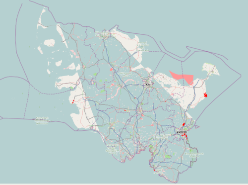
This Schleswig-Holstein extract contains coastlines only up to the border with Denmark (and to the rest of Germany), so the coastline cannot be closed.
The workaround is to change the behavior of Maperitive's coastline processor by changing the value of map.coastline.mode setting. The setting can have following values:
